 Photo image.
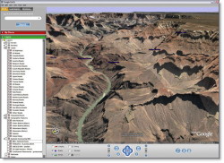
 Grand
Canyon show from Google Earth -
© Copyright Google.
Sophisticated streaming technology delivers the data to you
as you need it. Imagery and 3D data depict the entire earth. It's all stored in
a database which is continuously updated through information from satellites.
You can quickly zoom from space down to detailed level and combine imagery,
3D geography, maps, and business data to get the total picture in seconds.
You can use Google Earth for several purposes:
Exploring the world
Planning a trip
Getting driving directions
Finding a house or
apartment
Finding a local business
Satellite images and local facts zoom into view. You can use Google search
function to find local points of interest and facts, for example zoom to a
specific address to check out an apartment or hotel. You can also view driving
directions, distances and even fly along your route.
From amazing natural wonders like Grand Canyon and Kilimanjaro to romantic
cities like Barcelona, Rome and Paris to local restaurants and schools, Google
Earth puts a planet's worth of Earth imagery and other geographic information
right on your desktop.
Direct link for downloading the Google Earth software: http://kh.google.com/download/earth/index.html
For more information about Google`s software products: http://earth.google.com/earth.html
Website: http://earth.google.com/index.html
|
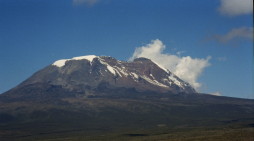
Photo. Kilimanjaro in its full pride.
©
Travel Explorations.
By using Google Earth, you can find the easiest way up. |
 |
You should also be aware of that Google`s data exchange format let your share
useful annotations and view thousands of data points created by Google Earth
users. By turning on the "Travel Advice"-function, it's possible to get travel
advice from other users of the tool. If you not find the places you are
searching for in Google Earth, you can check this User Forum. Here you can find
information about more unknown places. A discovery was recently done in Italia
of ancient ruins by using Google Earth.
A new thing is that African imagery and articles from National Geographic is
featured in Google Earth.
If you buy Google`s extensive software, the Google
Earth Pluss-edition, you can use the software to download data from your
GPS-receiver. Good luck with a wonderful experience.
Stein Morten Lund, 5 October
2005
